Royhon Agostine
Home
About
Resume
Portfolio Highlights
Scholars Week Project: Temporal Analysis Comparison
Climate Envelope
Cartographic Skills: Adobe Illustrator
Thiessen Polygon Analysis
NDVI, Training samples and Classification
Watershed Analysis
ENVS 420
Data Analysis: Intersect, Clip and Identity
Bellingham Walkability Analysis
Projections and Density
Thiessen Polygon Analysis
Student Enrollment: comparison of classifications
Census Data: Coastline Locations
Swiss Hillshade and Path Cost Analysis
Olympic Peninsula Swiss-Hillshade
Climate Envelope
Thiessen Polygons: World Population Proximity to Capitals
ENVS 421
Historical GIS: Georeferencing
NDVI, Training samples and Classification
Watershed Analysis
GPS and Georeferencing
Stillaguamish Watershed: Applying an Iterator in Model Builder
Habitat Suitability Analysis: Multiple Variables
Contact
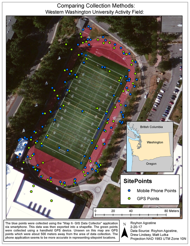
Using both a handheld cellular device application, and a handheld GPS, sample points were manually recorded in the field and then overlayed with a aerial image. The points were georeferenced and used to create polygons and lines based on land cover.
Home
About
Resume
Portfolio Highlights
Scholars Week Project: Temporal Analysis Comparison
Climate Envelope
Cartographic Skills: Adobe Illustrator
Thiessen Polygon Analysis
NDVI, Training samples and Classification
Watershed Analysis
ENVS 420
Data Analysis: Intersect, Clip and Identity
Bellingham Walkability Analysis
Projections and Density
Thiessen Polygon Analysis
Student Enrollment: comparison of classifications
Census Data: Coastline Locations
Swiss Hillshade and Path Cost Analysis
Olympic Peninsula Swiss-Hillshade
Climate Envelope
Thiessen Polygons: World Population Proximity to Capitals
ENVS 421
Historical GIS: Georeferencing
NDVI, Training samples and Classification
Watershed Analysis
GPS and Georeferencing
Stillaguamish Watershed: Applying an Iterator in Model Builder
Habitat Suitability Analysis: Multiple Variables
Contact